Wayfinding in Harare, Zimbabwe
As a European design agency, we don’t always look beyond our realm to discover what our trade looks like in regions around the world. We were reminded of this and its importance when intern Nicola Norton gave us perspective and new knowledge about wayfinding in Harare, Zimbabwe. Through her research our scope broadened, and we now wish to share her findings with you:
If you don’t live in Zimbabwe, you may not know much about it, besides maybe that it made it into the Guiness Book of Records for its hyperinflation in 2009 (we had a $100 trillion bank note!). In this first part of sharing my research project – “How people find their way in Harare” – I thought it apt to give some pretext.
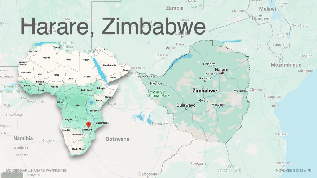
1. The Place: 🌍 Harare is the capital city of Zimbabwe, a landlocked country located in Southern Africa. It’s metropolitan area is home to approximately 2.4 million, spread over an area of over 1,000 square kilometres.
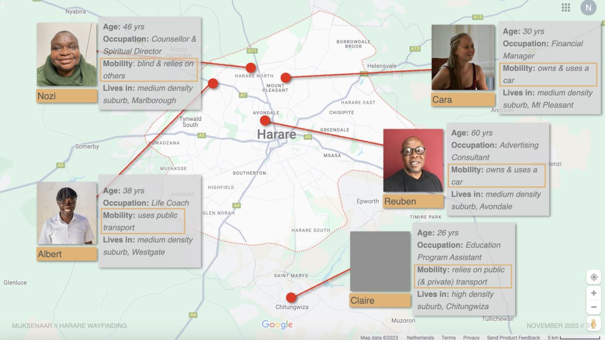
2. The People: 😊 I selected 5 people to interview, differing in age, gender, location, occupation and mobility. It is by no means an accurate cross-section of the city, but it reflects something of the diversity of user-groups when it comes to wayfinding in Harare. None of them had heard of “wayfinding” as a concept before, but entered into the questions with the usual storytelling vigour of Zimbabweans.
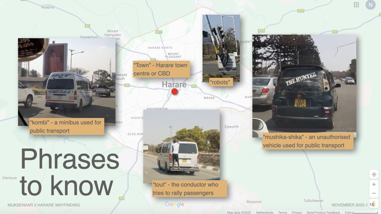
3. The Project: 🗺 To answer the broader question of how people experience wayfinding in Harare, I asked the 5 people how they get around, how they mentally map the city, and how they use their phone when moving around. The responses to these three areas of interest gave me a tale of “robots”, “touts”, “mushika-shikas” and more to unravel…
The context of Harare as it relates to wayfinding is one of blended formality and informality, with a strong leaning towards the latter.
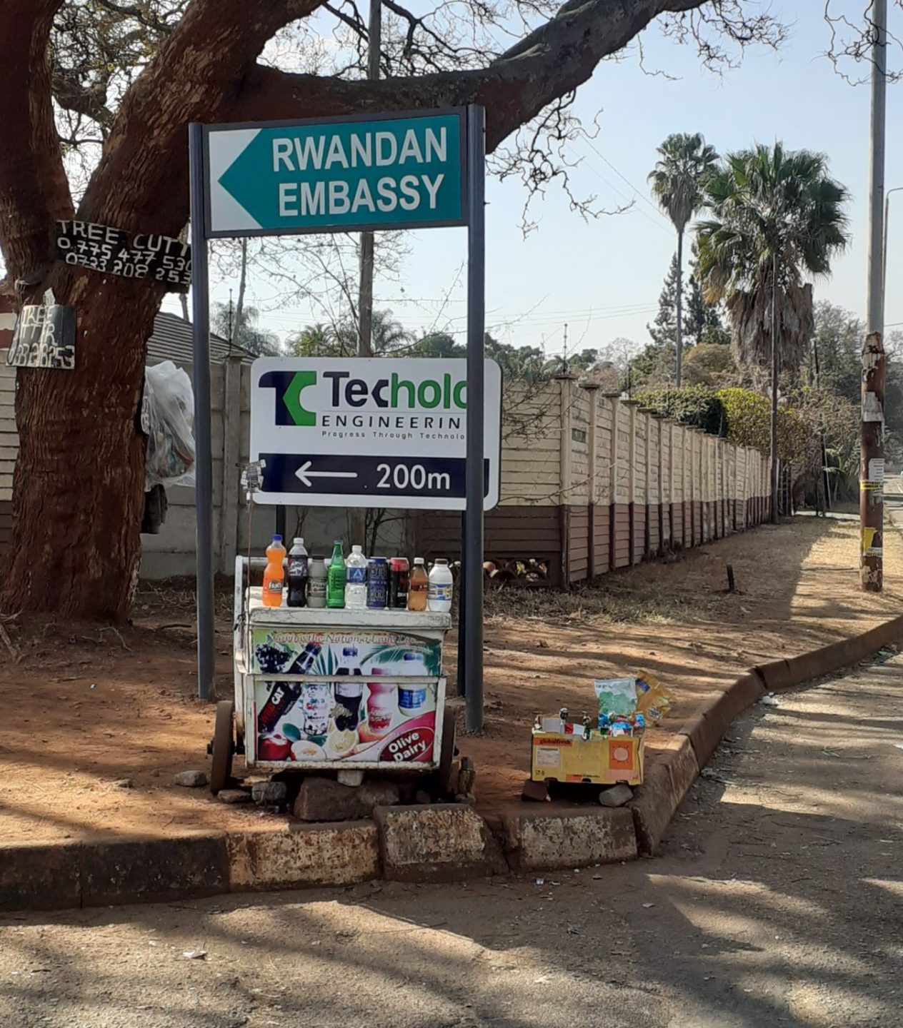
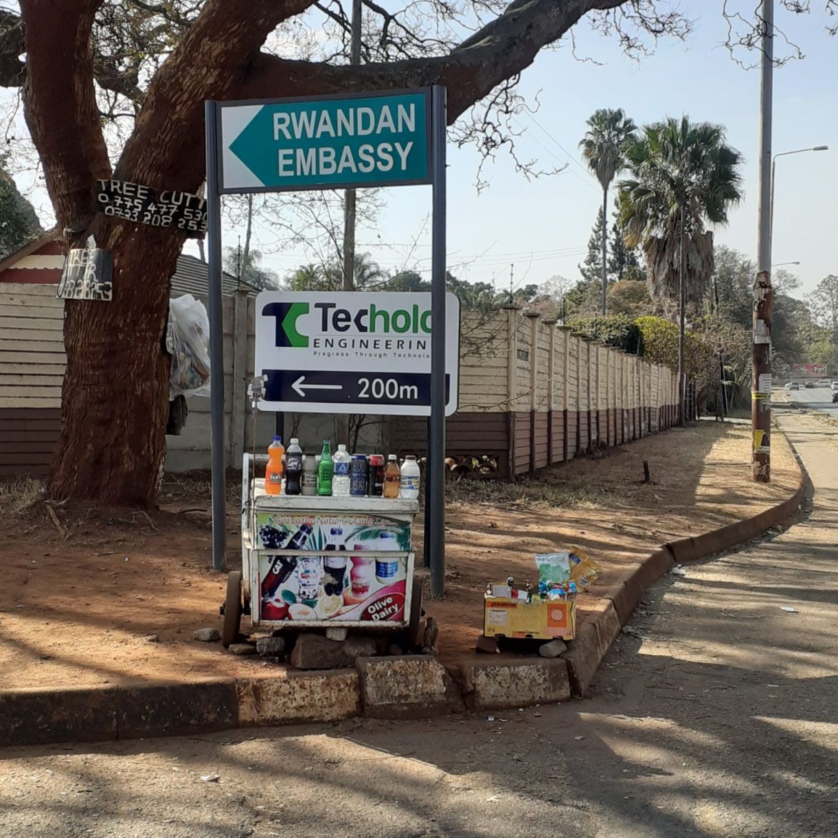
Unlike Amsterdam and other European cities, Harare’s city infrastructure is not maintained, updated and expanded to meet the needs of the current population. Road repairs have gotten better, but there are still lots of badly potholed roads, faded zebra crossings, missing lane demarcations, dilapidated street and traffic lights, and sometimes information like street signage is just plain old missing.
Unfortunately, the use and respect of this remaining infrastructure is also often less than satisfactory. Rules of the road are disregarded by many drivers, not all of whom have their driver’s license. Orange lights signal “speed up and get through quick”. Zebra crossings are driven over at high speed regardless of whether people are waiting to cross. Consequently, pedestrians navigate the streets with a different attitude too. They jaywalk, and generally know they need to be hyper alert of vehicle traffic.
Pedestrian and cycle paths were put in many years ago in some parts of the city but, they have not been maintained, by no means create a complete network across the city, or meet the demands of pedestrians. This can be seen by the informal paths that pedestrians have worn on roadsides. Similarly, there are some official bus ranks and bus stops located across the city, but the need of more convenient stops is not met by this formal provision. This is why you will also see many informal bus stops. A darkened, worn dirt patch next to the road after a busy intersection, for example.
At MIJKSENAAR, I learnt the value of assessing the ‘visual landscape’ of a wayfinding environment. This means looking at what is contending for users’ visual attention as they move through the space.
In Harare, the visual landscape is busy, with no clear hierarchy of information. There is the often dilapidated or missing formal infrastructure. When there, the official street signs are small in size compared to the huge, flashy commercial billboards increasing across the city. Added to this is the informal signage and roadside businesses. Nailed to many a tree, you will see handpainted wooden boards advertising tree cutting services. At major intersections, informal vendors will stand selling their umbrellas, fruit, toilet paper or current ‘bestseller’ to vehicle users. On many street corners, informal vendors will “set up shop” with a simple cooler box, impromptu table, and the kinds of snacks and fresh food they know will attract passing pedestrians.
Combine the crazy driving into all of this, and you might well wonder how people do actually find their way around this vibrant urban landscape! As you might expect, it depends on the person. As with the 5 people I interviewed, location, mobility, and physical ability all affect the wayfinding experience in Harare.
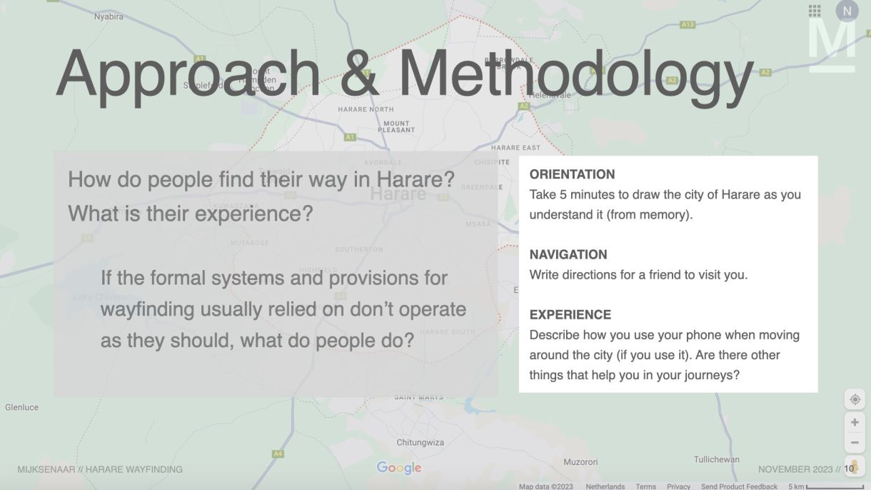
So, if Harare’s visual landscape is cluttered, and the formal systems and wayfinding information the West usually rely on are not available, how are people finding their way around this city?
Through the 5 interviews I conducted and my own experience, I discovered that it is a divided experience based on location📍, mobility 🚗 and physical ability 👁.
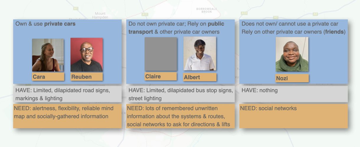
Not surprisingly, for Harare residents, there is a mistrust of formal provisions. Instead, they rely on other wayfinding assets:
1. first-hand knowledge of places (especially landmarks), and of unwritten systems and information (especially for public transport) 🧠
2. social networks and interactions 👥
and 3. personal mobile phones 📱.
Nozi: 👁 Independent wayfinding is close to impossible if you are blind. 👥 Nozi is completely dependent on people she knows to help her get to places. 📱 Her mobile phone is her means of connection, either in organising a lift, or in bringing ‘places’ or activities to her.
Reuben & Cara: 🚗 It is easier to find your way around Harare if you drive or have access to a private car. As car drivers, Reuben and Cara are able to cover unlimited ground. 📱 Google Maps is useful to them but it cannot provide the level of detail they always need for certain routes (like which way has the least potholes). 🧠 However, they do have ‘big picture’ mental maps of the city, which they could draw on when needing to navigate, and will also sometimes ask the advice of friends. 👥
Claire & Albert: 🚌 It is more complicated if you rely on public transport. As public transport users, Albert and Claire can only go where public transport goes (usually covering the rest by foot). Consequently, they did not have mental maps of the whole of Harare. 🧠 However, what was more important to them, was all the unwritten things they knew about navigating formal and informal public transport, like where to stand, how to know which vehicle to get into, what the pros and cons are for each type, etc. 📱👥 They also rely on social media to connect them with safe transport. Having once been robbed in an informal taxi, Claire prefers to organize a lift with the neighbourhood doctor. Albert makes use of a passenger-run WhatsApp group to find out when the next informal taxi will be able to pick him up.
📍 Wayfinding is also easier in specific areas, notably older residential areas like Reuben and Cara’s neighbourhoods, where road names and signage have mostly remained. It is more difficult in newer residential areas like where Albert lives, where roads have not yet been named and signposted, and house numbers do not exist. It is also difficult in high density areas like Claire’s, where the growth rate outpaces the formal system’s ability of to keep up. 🧠 In the more difficult areas, landmarks and socially given information are essential. 👥 Your best bet is to ask for directions.
Curious to know more? Please reach out to the writer, Nicola Norton